Farm Drone Survey: Complete Guide to Aerial Agriculture Technology in Mozambique 2026
Farm drone survey technology is transforming agriculture worldwide, and Mozambique is poised to benefit. The global agricultural drone market is projected to reach $6.72 billion by 2035 (up from $1.63 billion in 2025). With 36 million hectares of arable land and only 15% cultivated, Mozambique needs aerial survey technology more than any country in Africa. This guide covers drone survey technology, investment opportunities, and how MBC uses drones for crop monitoring.
Farm Drone Survey: What It Is
How Drone Surveys Work
- Flight planning: Drone flies autonomous grid pattern over farm
- Image capture: Multispectral camera captures NDVI, RGB, and thermal data
- Processing: AI analyzes images for crop health, pests, water stress
- Output: NDVI maps, yield estimates, stress alerts
- Action: Farmer receives advisory via M-Pesa SMS
Drone Types for Agriculture
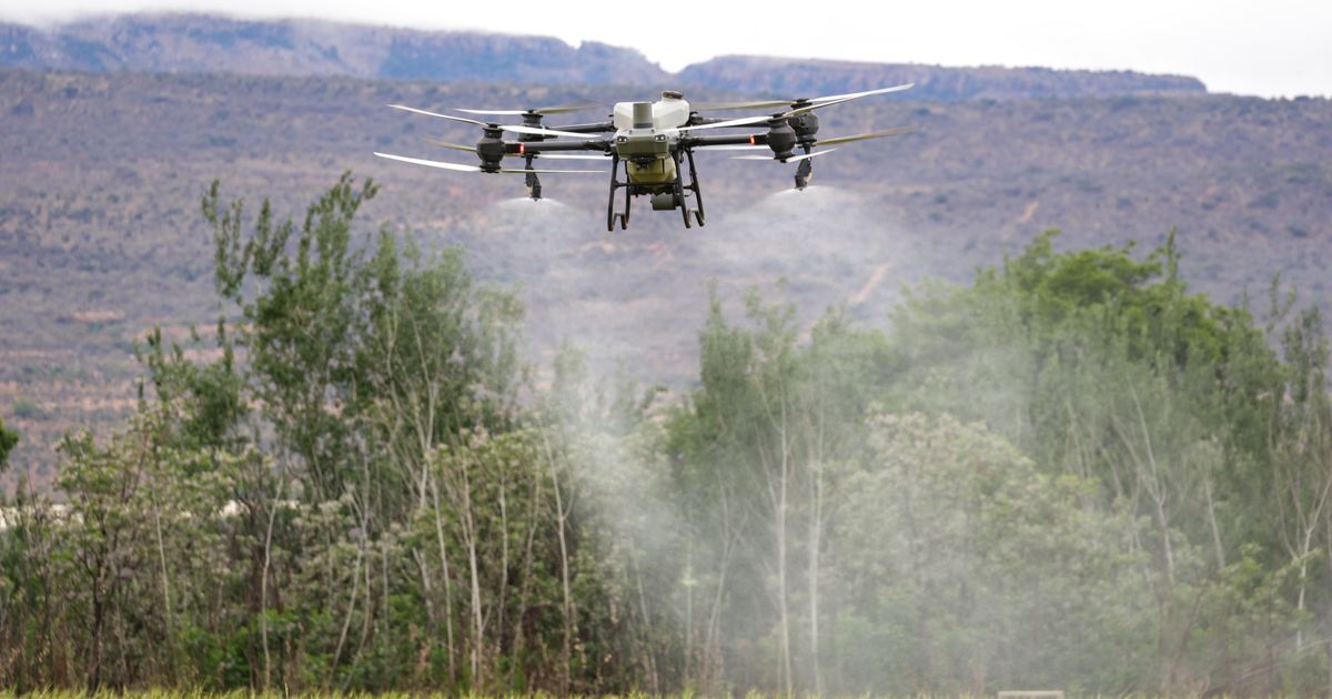
| Drone Type | Use Case | Price Range | Capability | |-----------|---------|------------|------------| | Multispectral | Crop health (NDVI) | $5,000-$15,000 | 5-band imagery, crop stress | | RGB camera | Field mapping | $2,000-$8,000 | Visual inspection, boundary | | Thermal | Water stress | $8,000-$20,000 | Irrigation management | | Spraying drone | Crop treatment | $15,000-$50,000 | Precision spraying | | LiDAR | Topography | $20,000-$80,000 | Terrain mapping |
What Drone Surveys Detect
- Water stress — thermal imaging shows drought before visible
- Pest pressure — NDVI anomalies reveal pest-affected areas
- Nutrient deficiency — multispectral detects NPK shortages
- Weed mapping — identifies weed pressure by zone
- Yield estimation — predicts harvest volume from biomass
- Crop boundary — verifies farm size for credit scoring
Why Mozambique Needs Drone Surveys
The Problem
- 3 million smallholder farmers with no crop monitoring
- 95% informal economy — no data on farm productivity
- 36 million hectares — too large to monitor from ground
- Extension agent ratio: 1 agent per 4,000 farmers
- Post-harvest loss: 30-40% of harvest lost
The Solution
- One drone can survey 100 hectares in 30 minutes
- AI analysis detects crop stress 14 days before visible
- M-Pesa alerts sent to farmers automatically
- Credit scoring improved with satellite + drone data
- Yield prediction at 85-92% accuracy
MBC Drone Survey System
MBC has built a DroneSurvey entity in its platform that tracks:
Drone Survey Data Captured
| Field | Example | |-------|---------| | Farmer name | Domingos Cumbane | | Province | Zambezia | | Area covered | 5.2 hectares | | NDVI average | 0.72 | | NDRE average | 0.35 | | Crop health score | 82/100 | | Estimated yield | 2,100 kg | | Water stress | None detected | | Pest pressure | Low (5%) | | Weed detection | 8% coverage | | Nutrient deficiency | Nitrogen low | | AI recommendations | Apply compost, monitor south zone | | Drone type | Multispectral | | Resolution | 3.5 cm/pixel | | Flight altitude | 80m |
How Drone Data Feeds Credit Scoring
MBC's satellite credit scoring uses drone NDVI data as one of 6 sources:
- Drone NDVI (crop health) — 25% weight
- M-Pesa transaction history — 20% weight
- Weather data (Open-Meteo) — 15% weight
- Farm profile (size, crops, experience) — 15% weight
- Repayment history — 15% weight
- Community verification — 10% weight
Investment Opportunities in Farm Drone Surveys
1. Drone Service Provider ($25K - $100K, 30-50% IRR)
Model: Purchase 2-5 agricultural drones, offer surveying services Revenue: $5-15 per hectare surveyed Market: 3 million smallholder farmers, commercial farms, cooperatives Payment: Via M-Pesa Technology: Sourced from Asia at 50-70% lower cost
2. Drone-as-a-Service (DaaS) Platform ($100K - $500K, 25-40% IRR)
Model: Subscription-based drone surveying for cooperatives Subscription: $50-200/month per cooperative Coverage: Up to 500 hectares per drone per day Data delivery: NDVI maps + AI recommendations via M-Pesa SMS
3. AI-Powered Drone Analytics ($50K - $250K, 35%+ IRR)
Model: Software platform analyzing drone imagery Technology: Machine learning models for pest, disease, yield prediction Market: Drone operators, agribusinesses, government Accuracy: 85-92% yield prediction, 30-50% crop loss reduction
4. Drone Training and Certification ($10K - $50K, 40%+ IRR)
Model: Train Mozambican pilots to operate agricultural drones Course: 2-week certification program Market: Youth unemployment 65% — drone piloting is high-skill job Platform: MBC education portal
5. Drone Equipment Marketplace ($50K - $250K, 20-30% IRR)
Model: Import agricultural drones from China/India at low cost Supplier: DJI Agriculture, XAG, custom builds Market: Mozambican agribusinesses upgrading technology Platform: MBC equipment marketplace
Farm Drone Survey: Key Facts
| Metric | Value | |--------|-------| | Global market (2025) | $1.63 billion | | Global market (2035) | $6.72 billion | | Growth rate | 15.3% CAGR | | Area surveyed per drone/day | 100 hectares | | Flight time per survey | 30 minutes | | NDVI accuracy | 85-92% yield prediction | | Early warning benefit | 14 days before visible damage | | Crop loss reduction | 30-50% | | Input cost reduction | 20-30% (precision spraying) | | Mozambique arable land | 36 million hectares | | Extension agent ratio | 1:4,000 farmers | | Drone price (multispectral) | $5,000-$15,000 |
How MBC Supports Drone Investment
DroneSurvey Entity
MBC's platform includes a DroneSurvey entity that stores survey results — NDVI, yield estimates, pest detection, and AI recommendations.
Asia Bridge Sourcing
MBC's Asia Bridge connects investors to low-cost drone manufacturers in China and India — 50-70% cheaper than Western alternatives.
Satellite + Drone Integration
MBC combines satellite NDVI (broad coverage, low resolution) with drone NDVI (precise coverage, high resolution) for the most comprehensive crop monitoring in Africa.
Mobile Money Integration
All drone service payments — farmer fees, operator payments, equipment purchases — settle via M-Pesa.
Transparent Fees
Our fee structure: 70% to operator, 9% MBC margin, 15% reserve.
Conclusion
Farm drone survey technology represents one of the highest-ROI agricultural investments available. With 36 million hectares of arable land, 3 million unmonitored farmers, and 30-50% crop loss rates, Mozambique needs aerial agriculture technology more than any country in Africa. MBC provides the platform — DroneSurvey entity, Asia Bridge sourcing, satellite+drone integration, and M-Pesa payments — to make drone investment transparent and profitable.