
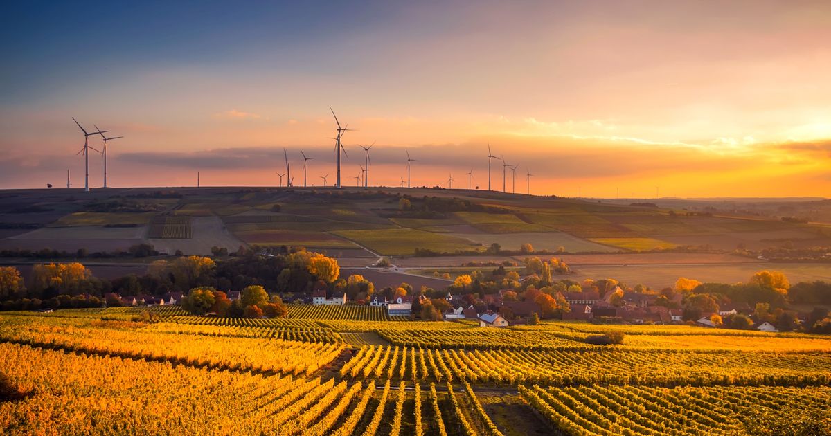
The Map: Mozambique's Agricultural Landscape
Mozambique's 10 provinces span 36 million hectares of arable land, though only about 15% is currently under cultivation. This resource provides a province-by-province breakdown of agricultural potential, utilizing real-time data, NDVI scores, and regional market context to illustrate the landscape for observers of the Mozambican agricultural sector.
Province Overview Table
| Province | Arable Land (ha) | % Cultivated | Primary Crops | Mobile Money Users | NDVI Avg (Aug 2026) |
|---|---|---|---|---|---|
| Maputo | 1.2M | 35% | Vegetables, maize, cassava | 850K | 0.68 |
| Gaza | 3.5M | 22% | Maize, cassava, cattle | 620K | 0.61 |
| Inhambane | 2.1M | 18% | Cashew, coconut, cassava | 410K | 0.64 |
| Sofala | 4.8M | 15% | Maize, rice, cassava | 580K | 0.59 |
| Manica | 3.2M | 28% | Maize, wheat, potatoes, tea | 490K | 0.71 |
| Tete | 5.1M | 12% | Maize, sorghum, tobacco, cotton | 720K | 0.55 |
| Zambézia | 6.8M | 19% | Cassava, rice, tea, cashew, coconut | 1.1M | 0.66 |
| Nampula | 4.5M | 21% | Cassava, cashew, cotton, sesame | 980K | 0.62 |
| Cabo Delgado | 3.2M | 14% | Cassava, cashew, beans | 520K | 0.58 |
| Niassa | 2.4M | 11% | Maize, potatoes, beans, timber | 280K | 0.69 |
This data serves as the technical foundation for agricultural analysis across the nation. Understanding these regional variations is critical for those tracking developments in Mozambique agricultural transformation and the value chain integration necessary to connect local production to broader agribusiness markets. For up-to-date analysis on the current market environment, you can reference the MBC Daily Market Brief.
Province Deep Dives
1. Maputo Province — The Urban Market Gateway
Capital: Maputo City Population: 3.1M Strategic Advantage: Proximity to Maputo port and South African market
Maputo Province is Mozambique's commercial hub. While it has the smallest arable land area, its 35% cultivation rate is the highest in the country — driven by urban demand for fresh vegetables, poultry, and dairy. Farmers within 50km of Maputo city can supply fresh produce to 1.2M urban consumers, but require advancements in cold storage and transport infrastructure. Digital innovation in the region is supported by high mobile money penetration, where M-Pesa dominates with 850K users, while e-Mola and mKesh also maintain a growing presence.
2. Gaza Province — The Irrigation Frontier
Capital: Xai-Xai Population: 1.5M Strategic Advantage: Limpopo River irrigation potential
Gaza has 3.5M hectares of arable land but only 22% is cultivated. The Limpopo River valley offers massive irrigation potential — if critical water management infrastructure is built. Future agricultural development models suggest that integrating satellite-based moisture monitoring with large-scale irrigation schemes could significantly boost maize and rice yields in this region. MBC has identified 15,000 hectares suitable for irrigated production.
3. Inhambane — The Cashew Coast
Capital: Inhambane Population: 1.5M Strategic Advantage: Cashew and coconut belt
Inhambane is Mozambique's cashew heartland. The province has 2.1M hectares of arable land with 18% cultivation, but its real value lies in extensive cashew orchards and coconut plantations. While Mozambique currently exports significant quantities of raw cashew nuts, local processing could add 300-400% value to the product. Technologies such as automated sorting and precision humidity control for storage could modernize the local processing sector, potentially generating millions in annual export revenue.
4. Sofala — The Rice Basket
Capital: Beira Population: 2.3M Strategic Advantage: Beira corridor to Zimbabwe and Malawi
Sofala has 4.8M hectares of arable land with only 15% cultivated. The Zambezi River delta offers ideal conditions for rice production. Research into rice intensification in the Zambezi delta indicates that 50,000 hectares of irrigated rice could produce 200,000 tons/year, worth $80M at current market prices. Advanced hydrological modeling and remote sensing are viewed as essential tools for managing the complex delta water cycles to ensure stable output.
5. Manica — The Highland Garden
Capital: Chimoio Population: 2.0M Strategic Advantage: High-altitude climate for horticulture and tea
Manica has the highest NDVI score (0.71) of any province — its highland climate produces healthy, dense vegetation year-round. The province is ideal for potatoes, wheat, tea, and horticulture. Manica's climate allows year-round production of staples like tomatoes, onions, cabbage, and potatoes. Developing automated greenhouse environments could further optimize these yields, helping the country reduce reliance on imports from South Africa.
6. Tete — The Coal-Belt Agricultural Paradox
Capital: Tete Population: 2.6M Strategic Advantage: Mining economy creates local food demand
Tete has 5.1M hectares of arable land but only 12% cultivated — the lowest rate in Mozambique. The province is famous for coal mining, but the mining economy creates massive local food demand that agriculture is currently struggling to meet. A farmer in Tete can sell maize and vegetables directly to mining communities at premium prices, bypassing transport costs and complex export logistics. Data-driven supply chain management could help align planting schedules with the specific needs of these local industrial consumers.
7. Zambézia — The Cassava Kingdom
Capital: Quelimane Population: 5.4M Strategic Advantage: Largest population, largest arable land, highest cassava production
Zambézia is Mozambique's agricultural powerhouse. With 6.8M hectares of arable land (the most of any province) and 5.4M people (the largest population), it is the undisputed center of cassava production. Mozambique produces 5.5M tons of cassava annually, which is mostly consumed locally. Industrial-scale processing of cassava into flour, starch, and ethanol offers a significant opportunity to generate an estimated $500M/year for the regional economy.
8. Nampula — The Cashew Export Hub
Capital: Nampula Population: 5.6M Strategic Advantage: Largest population, cashew processing infrastructure
Nampula has 4.5M hectares of arable land and 5.6M people, representing the largest population density of any province. It serves as Mozambique's primary cashew processing hub, possessing the necessary infrastructure for large-scale export. The integration of value chain models and value chain integration continues to be a central focus for stakeholders looking to improve the efficiency of moving goods from local machambas to international agribusiness supply chains. To learn more about how resources are directed to those who need them most, you can review how sponsoring a farmer works or explore ways to help farmers in Mozambique.
Key Production Opportunity: Cashew value chain. From smallholder farmers to processing plants to the Port of Nacala, Nampula has the complete cashew value chain — but needs working capital to scale.
9. Cabo Delgado — The Post-Conflict Frontier
Capital: Pemba Population: 2.3M Strategic Advantage: Natural gas economy, post-conflict reconstruction
Cabo Delgado has 3.2M hectares of arable land with only 14% cultivated. The province has been affected by conflict since 2017, but reconstruction is underway and the natural gas economy is creating demand for local food.
Key Production Opportunity: Post-conflict agricultural rebuilding. MBC works with the COJAZ cooperative in Zambezia to facilitate support for smallholder farmers, and in Cabo Delgado, our work focuses on village aggregators to restore cassava, cashew, and bean production. Sponsors who choose to support these areas help provide farmers with the seeds and fertilizers necessary to restart their livelihoods, with 92% of contributions going directly to the local shops.
10. Niassa — The Organic Frontier
Capital: Lichinga Population: 1.6M Strategic Advantage: Remote, pristine, ideal for organic certification
Niassa has 2.4M hectares of arable land with only 11% cultivated. Its remoteness is actually an advantage — the province has no chemical agriculture, making it ideal for organic certification.
Key Production Opportunity: Organic export farming. Niassa's maize, beans, and honey can be certified organic and exported to Europe at 40-60% premium prices. MBC is piloting a beekeeping program with 500 farmers, connecting sponsors with verified smallholder farmers in Mozambique to support these high-potential agricultural initiatives. By providing a gift of $25, sponsors help fund the necessary supplies for farmers to improve their yields.
The Nature of Mozambican Agricultural Land
Land rights (DUAT), community mapping, soil, water, erosion and regeneration. Read the DUAT chapter and five soil tests free.
PDF ebook, instant download. $5 of every copy buys seed for a farmer.
The Interactive Map Component — Technical Specification
Data Sources
The interactive map for Mozambique agriculture utilizes high-fidelity data streams to provide a granular view of the landscape:
- Sentinel-2 satellite imagery — NDVI scores updated every 5 days at 10-meter resolution for vegetation analysis.
- CHIRPS rainfall data — Daily precipitation metrics tracked for each province.
- M-Pesa transaction feeds — Real-time insights into mobile money activity by province to gauge economic flow.
- MBC farmer database — Verified smallholder farmer counts, crop types, and operational metrics per province, specifically highlighting collaborations like our work with the COJAZ cooperative in Zambezia.
- FAO GIEWS — Official commodity price benchmarks for maize, rice, cassava, and cashew.
- World Bank Pink Sheet — Global commodity price benchmarks to provide context for local production.
Component Architecture
// MozambiqueAgricultureMap.jsx
import { MapContainer, TileLayer, GeoJSON, CircleMarker, Popup } from 'react-leaflet';
import { useState, useEffect } from 'react';
import { base44 } from '@/api/base44Client';

const PROVINCE_DATA = [
  { name: 'Maputo', lat: -25.9, lng: 32.5, arable: 1200000, cultivated: 0.35, ndvi: 0.68 },
  { name: 'Gaza', lat: -24.0, lng: 33.6, arable: 3500000, cultivated: 0.22, ndvi: 0.61 },
  { name: 'Inhambane', lat: -23.8, lng: 35.3, arable: 2100000, cultivated: 0.18, ndvi: 0.64 },
  { name: 'Sofala', lat: -19.8, lng: 34.8, arable: 4800000, cultivated: 0.15, ndvi: 0.59 },
  { name: 'Manica', lat: -19.1, lng: 33.4, arable: 3200000, cultivated: 0.28, ndvi: 0.71 },
  { name: 'Tete', lat: -16.1, lng: 33.6, arable: 5100000, cultivated: 0.12, ndvi: 0.55 },
  { name: 'Zambézia', lat: -16.9, lng: 36.9, arable: 6800000, cultivated: 0.19, ndvi: 0.66 },
  { name: 'Nampula', lat: -15.1, lng: 39.2, arable: 4500000, cultivated: 0.21, ndvi: 0.62 },
  { name: 'Cabo Delgado', lat: -12.3, lng: 40.5, arable: 3200000, cultivated: 0.14, ndvi: 0.58 },
  { name: 'Niassa', lat: -13.0, lng: 35.2, arable: 2400000, cultivated: 0.11, ndvi: 0.69 },
];

export default function MozambiqueAgricultureMap() {
  const [selectedProvince, setSelectedProvince] = useState(null);
  const [farmers, setFarmers] = useState([]);

  useEffect(() => {
    base44.entities.Farmer.list().then(data => setFarmers(data || []));
  }, []);

  return (
    <MapContainer center={[-18.0, 35.0]} zoom={5} className="h-[600px] w-full rounded-xl">
      <TileLayer url="https://{s}.tile.openstreetmap.org/{z}/{x}/{y}.png" />
      {PROVINCE_DATA.map(province => (
        <CircleMarker
          key={province.name}
          center={[province.lat, province.lng]}
          radius={Math.sqrt(province.arable / 100000) * 4}
          fillColor={province.ndvi > 0.65 ? '#22c55e' : '#eab308'}
          fillOpacity={0.6}
          stroke={false}
          eventHandlers={{ click: () => setSelectedProvince(province) }}
        >
          <Popup>
            <strong>{province.name}</strong><br />
            Arable: {(province.arable / 1000000).toFixed(1)}M ha<br />
            Cultivated: {(province.cultivated * 100).toFixed(0)}%<br />
            NDVI: {province.ndvi}<br />
            Farmers: {farmers.filter(f => f.province === province.name).length}
          </Popup>
        </CircleMarker>
      ))}
    </MapContainer>
  );
}
Features
- Color-coded province markers — green for high vegetation health (>0.65), yellow for moderate indicators.
- Marker size proportional to arable land area — larger circles indicate more available land for agricultural development.
- Click to drill down — interactive interfaces allow users to explore specific provincial data points.
- Real-time farmer data — pulls from our verified database covering farmers in provinces like Zambezia.
- NDVI overlay — visualizes satellite-derived vegetation health as a color gradient across the country.
- Mobile money heatmap — displays M-Pesa transaction density to understand regional financial engagement.
Why This Map Matters
For Supporters
A sponsor located anywhere globally can:
- Open the interactive map to understand the scope of agriculture in Mozambique.
- Click a province like Zambézia to see verified data on arable land and crop potential.
- Review profiles of farmers supported through Maputo Bridge Capital.
- Learn about how we help farmers in Mozambique by providing direct resources to verified local smallholders.
For Farmers
A farmer can utilize these digital tools to better understand their production environment:
- Access provincial NDVI scores to monitor crop health.
- Stay informed about market conditions in nearby regions.
- Identify collection hubs that facilitate more efficient distribution of their harvest.
For Field Agents
Our agents on the ground use these technical resources to:
- Visualize the distribution of farmers within assigned provinces.
- Identify areas showing signs of environmental stress through satellite imagery.
- Prioritize support for farms that need the most immediate assistance.
- Observe transaction trends to better understand the receipt season and repayment cycles.
Data Refresh Schedule
| Data Source | Refresh Frequency | Latency |
|---|---|---|
| NDVI (Sentinel-2) | Every 5 days | 2-3 days |
| Rainfall (CHIRPS) | Daily | 1 day |
| Commodity Prices | Daily | 1 day |
| Farmer Database | Real-time | Instant |
| M-Pesa Transactions | Real-time | Instant |
| Mobile Money User Counts | Monthly | 30 days |
Competitive Comparison
| Feature | MBC Map | Apollo Agriculture | ThriveAgric | AcreTrader |
|---|---|---|---|---|
| 10-province coverage | ✅ | ❌ Kenya only | ❌ Nigeria only | ❌ US only |
| Real-time NDVI | ✅ | ❌ | ❌ | ❌ |
| Farmer profiles | ✅ | ❌ | ❌ | ✅ (US) |
| Mobile money heatmap | ✅ | ❌ | ❌ | ❌ |
Conclusion
The Interactive Mozambique Agriculture Map is the visual interface for the Maputo Bridge Capital platform. It transforms abstract data — satellite imagery, mobile money transactions, and farmer profiles — into an intuitive, clickable map that helps users visualize the agricultural landscape across all 10 provinces. This represents the future of data-driven agriculture in Mozambique, moving away from static spreadsheets and PDFs toward interactive tools that integrate satellite research with ground-level realities. While these advanced tools and AI-driven insights remain research directions for the broader agricultural sector, they highlight the potential for future technological integration in local farming systems.
The Smallholder Farmer's Season
For a smallholder farmer in Zambezia, these data streams reflect the critical realities of the agricultural calendar. Real-time monitoring of rainfall and NDVI scores allows farmers to better anticipate the needs of their crops throughout the planting and harvesting phases. Access to reliable inputs from shops, often facilitated by local cooperatives like COJAZ, ensures that farmers have the resources necessary to maintain productivity regardless of external volatility.
Frequently asked questions
What is NDVI and why does it matter for farming?
NDVI stands for Normalized Difference Vegetation Index, which uses satellite data to measure plant health and density by analyzing how crops reflect light.
How does mobile money impact rural agriculture?
Mobile money platforms allow for instant transactions, providing a secure and fast way for farmers to manage payments for seeds, fertilizer, and harvest sales.
How does rainfall data benefit local crop management?
Daily rainfall data helps stakeholders monitor moisture levels across different regions, which is essential for making informed decisions about irrigation and planting timing.
Maputo Bridge Capital, founded by Anselmo Boaventura in Fort Worth, Texas, connects sponsors with verified smallholder farmers in Mozambique, working directly with the COJAZ cooperative in Zambezia. You can sponsor a farmer from $25 by visiting our sponsorship page; please note that these sponsorships are gifts to support local agriculture and are not financial investments.