
Mozambique Drone Agriculture: Aerial Surveying for Farmers
Drone technology is transforming agriculture by mapping fields, spraying crops, monitoring disease, and counting livestock from the air. In Mozambique, where challenging infrastructure can make remote farm access difficult, drones offer a way to modernize agricultural surveying at a fraction of traditional costs.
Drone Applications in Agriculture
1. NDVI Crop Mapping ($5-10/hectare)
- Multispectral drone captures NDVI imagery at 5cm resolution (vs 10m for satellite)
- Reveals: crop stress, nutrient deficiency, pest damage, water stress
- Advantage over satellite: Cloud-free, on-demand, higher resolution
- Cost: $5-10/ha (vs $50-100/ha for ground surveying)
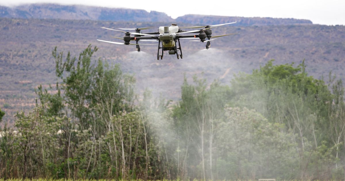
2. Precision Spraying ($8-15/hectare)
- Drone applies pesticide/herbicide precisely where needed
- Reduces chemical use 30-50% (vs blanket spraying)
- Speed: 20-50 hectares/hour (vs 2-5 with manual sprayer)
- Advantage: No crop trampling, no worker exposure to chemicals
3. Plant Counting and Stand Assessment
- Drone counts plants per hectare — identifies gaps in planting
- Helps farmers know if replanting is needed
- AI software: Count plants automatically from drone imagery
4. Irrigation Monitoring
- Thermal drone imagery detects dry spots in irrigated fields
- Identifies broken sprinklers, blocked canals, uneven water distribution
- Saves 20-30% water by fixing leaks
5. Yield Estimation
- Drone maps crop canopy density → predicts yield 4-8 weeks before harvest
- Helps farmers and buyers plan logistics and pricing
- Accuracy: ±10% (vs ±30% for visual estimation)
Impact on the Smallholder Farmer's Season
For a smallholder farmer, these technologies mean shifting from reactive measures to proactive management. During the planting stage, aerial stand assessment ensures optimal density. Throughout the growing season, precision mapping allows for targeted nutrient and water application, while pre-harvest yield estimation provides the farmer with better data to negotiate prices with buyers, ultimately improving their financial stability.
The Nature of the Harvest
Agriculture as the engine of wealth: ten great books on farming, land, seed, water, risk and innovation, and who funds agriculture in Mozambique.
PDF ebook, instant download. $5 of every copy buys seed for a farmer.
Drone Economics
Equipment Costs
| Drone Type | Cost | Use Case | Payload |
|---|---|---|---|
| DJI Mavic 3 Multispectral | $5,000 | NDVI mapping | Camera only |
| DJI Agras T10 | $15,000 | Spraying | 10L tank |
| DJI Agras T40 | $25,000 | Spraying | 40L tank |
| Fixed-wing survey drone | $10,000-30,000 | Large area mapping | Camera |
Service Business Potential
| Service | Price/ha | Speed (ha/day) | Daily Revenue |
|---|---|---|---|
| NDVI mapping | $8 | 100 | $800 |
| Spraying | $12 | 50 | $600 |
| Plant counting | $5 | 150 | $750 |
| Irrigation audit | $10 | 80 | $800 |
Regulatory Framework
Mozambique Drone Regulations (AACM)
- Commercial drone use requires license from Autoridade da Aviação Civil de Moçambique (AACM)
- Maximum altitude: 120m (400ft)
- Visual line of sight required (unless BVLOS waiver)
- No flying over crowds, airports, or military areas
- Remote pilot license required for commercial operations
- Registration: $100-500 per drone
Related guide: Climate-smart agriculture in Mozambique: 6 technologies helping farmers beat drought, floods and cyclones
Frequently asked questions
What is NDVI? NDVI stands for Normalized Difference Vegetation Index, a method used to measure plant health based on how the leaves reflect light.
How do drones reduce water usage in agriculture? Thermal cameras detect dry spots that are not visible to the naked eye, allowing farmers to identify and fix leaks in irrigation systems early.
Why is drone imagery better than satellite imagery for small farms? Drone imagery provides much higher resolution, typically 5cm compared to 10m from satellites, and can be captured on-demand regardless of cloud cover.
The Role of Maputo Bridge Capital
Maputo Bridge Capital (MBC), founded by Anselmo Boaventura in Fort Worth, Texas, connects sponsors with verified smallholder farmers in Mozambique, specifically working with the COJAZ cooperative in Zambezia. A sponsor gives from $25, which goes directly to the farmer's local seed and fertilizer shop, while the sponsor receives a receipt and field photos. These sponsorships are gifts, not investments, and are not tax-deductible. After harvest, farmers repay into a Community Fund to support the next farmer. You can sponsor a farmer from $25 here.
*Related: Agricultural Extension Services